The Ecology behind Naval Air Station Tillamook
The Musical Stone — Sam Lammie, in collaboration with Claude (Anthropic)
The road south out of Tillamook follows the bay edge before bending inland, and if you are paying attention, you will see it before you can make sense of it. A wall — a brown, corrugated, curved wall — rising from the valley floor with a scale that defies easy calculation. No context prepares you. Nothing nearby is remotely its size.
This is Hangar B. It is 1,072 feet long, 296 feet wide, and 192 feet tall — seven acres under a single roof, built in 1943 by the United States Navy from Douglas fir timber on a wartime schedule, with no serious injuries reported on the entire project. It is among the largest wooden structures on Earth. It was built to house blimps.

I have been here twice now. The difference between those two visits captures something important about the fragility of the things we build and the urgency of capturing them before they are gone.
Inside, 2024
The first time, I walked in. That is a sentence worth sitting with — walked in — because the experience of crossing the threshold of Hangar B under normal museum conditions is genuinely disorienting. The wooden truss structure overhead disappears into darkness. The floor stretches ahead of you like an airfield. The scale does not resolve; it simply continues.
On one wall, a graphic chart maps the comparative lengths of airships across the history of lighter-than-air flight. The Hindenburg at 803 feet. The USS Akron at 785 feet. Then descending through the ZPG-3W, the N-Class, M-Class — and finally the K-Class at 252 feet, the workhorse blimp this hangar was built to shelter. Modest by comparison, but still enormous: longer than two 747s parked nose to tail. The hangar's own length — 1,072 feet — is marked at the bottom of the chart. The K-Class blimps fit with room to spare. Eight of them at a time.

Across the floor, an F-14A Tomcat sits under the lights. Tail markings identify it as VF-14, the "Tophatters," assigned to the USS John F. Kennedy. Bureau number 159848. One of the Top Gun production aircraft, now here in a WWII blimp hangar on the Oregon coast, someone's work buckets on the wet floor beside it, restoration underway. The juxtaposition is almost too much — Cold War naval aviation artifact inside a Second World War lighter-than-air infrastructure, both fighting obsolescence on different timescales.

Nearby, the forward fuselage section of a B-52 Stratofortress sits on a yellow cradle, nose art reading Osiris — the Egyptian god of the dead rendered in classic wartime pinup style, serial number 2579 still legible, the Air Force shield still crisp. The dead god presiding over the dead aircraft in the living hangar.

What holds it all together — literally — is the Douglas fir overhead. Those trusses were raised in 1943 under wartime urgency, no serious injuries, the whole project completed on a military schedule that would be unimaginable today. The wood has darkened but held. Standing beneath it, you understand that the builders knew something about permanence that the era of steel and concrete has partly forgotten.
What the Valley Required
The Navy did not choose this valley arbitrarily. They were reading a landscape, and the landscape had been shaped by forces operating on timescales that make wartime urgency look brief.
Tillamook sits at the confluence of five rivers draining the Coast Range — the Tillamook, Trask, Wilson, Quilcene, and Miami — all emptying into Tillamook Bay, one of Oregon's largest estuaries. The bay is a drowned river mouth, a product of Holocene sea-level rise filling a valley the rivers had already been building for millennia. The sediment those rivers deposited across the valley floor created something rare on the rugged Oregon coast: flat, stable ground, large enough to maneuver lighter-than-air craft, close to open water.
The maritime climate sealed the logic. Annual precipitation runs 80 to 100 inches. Persistent coastal fog — driven by cold upwelling water offshore — moderates temperatures year-round. Perennial ryegrass and clover grow almost without interruption. These conditions made Tillamook ideal for dairy farming, which is why the county had the infrastructure — roads, rail, power — that military logistics required. The same geomorphic processes that built the dairy pastures built the airfield. The Navy was, whether they thought of it in those terms or not, reading an ecological system and embedding within it.
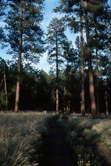
Seen from across the valley floor, with the Coast Range rising behind and the dairy pastures running green to the hangar's base, this is almost visually self-explanatory. The mountains drive the rainfall. The rainfall feeds the rivers. The rivers build the plain. The plain supports the farms and, in 1942, the station. One photograph contains the entire argument.
The Threat Offshore
The strategic logic was equally ecological. Japanese submarines operated in Pacific coastal waters in the months following Pearl Harbor, targeting shipping lanes with enough success to create genuine alarm. The Oregon coast's proximity to those lanes made blimp patrol coverage a military priority.
What made those lanes worth protecting was itself an ecological fact. The Oregon coast sits atop one of the world's most productive marine upwelling systems — cold, nutrient-rich water driven to the surface by offshore winds, fueling phytoplankton blooms, forage fish, salmon, Dungeness crab, and the entire food web built on top of them. Commercial fishing, timber transport by sea, military logistics — all converged in that same nearshore zone. The ecology that made the coast biologically extraordinary also made it strategically significant.
The K-Class blimps stationed here — eight of them, each 252 feet long, filled with 425,000 cubic feet of helium, capable of staying aloft for three days and ranging 2,000 miles — were well suited to the task. Patient, slow, able to loiter over convoys, effective enough against submarines that the mere presence of a blimp overhead was often deterrent enough. The fog that is so characteristic of this coast complicated blimp operations but also obscured coastal movement from offshore observation. Microclimatic ecology as tactical variable.
Outside the Fence, 2026
The second visit was different.
On December 18, 2025, severe winds tore open a section of Hangar B's roof — roughly 170 feet long and 30 feet wide — leaving the structure exposed to the elements and forcing indefinite closure. When I returned in spring 2026, I could not go inside. The fencing had been extended around the perimeter. The concrete portal frames of the end-wall door supports rose above the road — those massive pylons, fifteen or twenty stories of wartime engineering — but the doors they once supported were gone, or going, and the hangar itself was closed to the public for the first time in decades.


The Stratocruiser outside the fence line was still there, weathering. The Tophatters F-14 was inside, inaccessible. The Osiris B-52 nose, the scale chart, the Douglas fir trusses — all of it behind chain-link and caution tape while engineers and fundraisers worked out whether $20 million, or $30 million, or $50 million could be found to stabilize and restore a structure the National Register of Historic Places has recognized as irreplaceable.

A lidar drone has been flown to create a three-dimensional structural model. Federal funding requests have gone to the offices of Senators Wyden and Merkley. The Friends of Tillamook Air Museum have launched a Save Hangar B campaign. Repairs are not expected until 2027 at the earliest.
This is where history lives when institutions are fragile: in the gap between what a place contains and what it costs to keep it.
Why Capture Matters
I am a geospatial professional by training and career. I spent decades working with the tools and disciplines that document landscapes, structures, and change over time. The lidar scan being used to assess Hangar B's storm damage is the same basic technology I worked with for years on the National Forests — point clouds, structural models, change detection. It is gratifying that it is being applied here. It is also a reminder that documentation is not preservation. A perfect three-dimensional model of a collapsed building is still a record of loss.
The photographs I made inside Hangar B in 2024 are primary documents now. The F-14 under the lights, the truss work overhead, the scale chart on the wall, the Osiris nose section in its yellow cradle — these images capture a moment that may not return, or may return changed in ways that cannot be fully anticipated. That is what photographs do when institutions are in crisis: they become the record that survives when the thing itself does not, or not in its current form.
This is not unique to Tillamook. It is the condition of physical heritage everywhere — contingent, expensive, vulnerable to the same forces that built it. The same coastal storms that made this valley's climate hospitable to dairy farming and blimp operations are the storms that peeled back 170 feet of Hangar B's roof in December 2025. The landscape gives and takes on its own schedule.
What Persists
The valley is still dairying. The bay is still ecologically stressed — agricultural runoff from those same fertile pastures continues to challenge water quality and salmon habitat, a tension that was present in 1942 and remains unresolved. The upwelling offshore still drives one of the world's most productive marine ecosystems. The fog still comes in off the cold water, still moderates temperatures, still shapes what grows and what is possible here.
The Navy read this landscape correctly in 1942. They found what they needed because ecology had already organized it. What they built in response — the hangars, the station, the patrol network — was immense and consequential and is now mostly gone or imperiled. One hangar burned in 1992. The other is fighting for its life.
But the ecological logic that selected this valley has not changed. The rivers still build their plain. The mountains still drive the rainfall. The upwelling still feeds the nearshore. If Hangar B survives — if the funding comes through, if the Douglas fir holds, if the storms relent long enough for the repairs to be made — it will stand because human intention and institutional capacity aligned, however temporarily, with the same geographic permanence that put it here in the first place.
If it does not survive, the valley will continue without it. The fog will come in off the upwelling. The grass will grow in the rain. The concrete pylons will stand a while longer, and then they too will go.
History requires witnesses. It also requires the structures that make witnessing possible. Right now, Hangar B needs both.
Photographs by the author. Interior images: Tillamook Air Museum, 2024. Exterior images: Tillamook, Oregon, spring 2026. To support the Save Hangar B campaign, visit tillamookair.com.
The Musical Stone is written by Sam Lammie. This post was developed in collaboration with Claude (Anthropic) as a research and writing partner. themusicalstone.blogspot.com
![]()

No comments:
Post a Comment