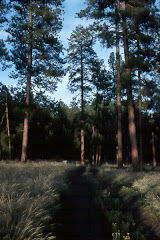
Thursday, May 7, 2026

Evening Wildflower Walk in the Sweathouse Creek Conservation Easement

The Bitterroot Valley, May 2026


The invitation arrived the day before. Owen Yager of the Bitterroot Land Trust sent word that the organization was hosting a special guided wildflower walk for donors and supporters — a thank-you for their participation in Bitterroot Gives, which had just unlocked $15,000 for conservation projects up and down the valley. The walk would be led by Bitterroot National Forest staff including botanist, Laura Johnston and her assistant Hannah, a forestry technician. BRLT Next Gen Committee members and the public, would meet at the Sweathouse Creek trailhead at five o'clock. The temperature was forecast to be in the sixties. 

That is the practical summary. What actually happened was something closer to a tutorial in reading landscape.


The Bitter Root Land Trust works across the full length of the Bitterroot Valley, protecting what it describes as water, wildlife, and working lands. Since its founding, BRLT has conserved more than 15,000 acres through 70 conservation projects, keeping 53 miles of river and stream frontage undeveloped and green. In 2023 the organization received the Land Trust Excellence Award from the Land Trust Alliance, selected from among 1,000 partner land trusts nationwide. More information at bitterrootlandtrust.org.

The Sweathouse Creek Conservation Easement, on the west side of Victor, was conserved by the Hackett family in 2023 in partnership with Montana Fish, Wildlife and Parks, BRLT, and other local partners. The 540-acre easement borders the Bitterroot National Forest and holds the trailhead to Sweathouse Falls. It protects important agricultural land, public access, and valuable plant, fish, and wildlife habitat. The walk Owen organized that evening was one expression of what stewardship looks like in practice — not just holding land in conservation, but understanding what it contains.

After introductions in the parking lot, Laura didn't wait to begin. She turned to the treeline at the lot's edge and started naming what she saw. Grand fir — flat, two-ranked needles, smooth gray bark, a shade-tolerant species that moves into ponderosa parkland when fire is suppressed. Ponderosa pine — plated orange-gray bark, long needles in bundles of three, the signature tree of the valley's lower slopes. Cottonwood and aspen anchoring the riparian edge, their new leaves catching light. Aspen trembling at the meadow margin. Four species, four different ecological stories.

I asked about whitebark pine. Laura nodded — yes, it's in the range, but at higher elevations. Not here. Whitebark pine (Pinus albicaulis) is a subalpine species, found near treeline in the Bitterroots and across the Northern Rockies, where it plays an outsized ecological role as a source of high-fat seeds for Clark's nutcracker and grizzly bear. It is also a species under serious pressure — listed as threatened under the Endangered Species Act, declining across its range from white pine blister rust, mountain pine beetle, and a century of fire suppression that has allowed shade-tolerant competitors to crowd it out. Laura's answer placed it precisely: the whitebark belongs to a different elevation, a different community. What we were about to walk through was something else.

We set out up the road toward the gate entrance to the property.


Sweathouse Creek was running full — snowmelt white over moss-covered boulders, alder leaning into the current from both banks, a small diversion structure managing the flow toward the valley's irrigation network below. The Bitterroot Range is carrying ninety percent of normal snowpack this spring, and you could hear it in the creek. The mountains are not scenery here. They are the water supply. The Bitterroot Valley's farms and ranches have depended on snowmelt off this range for as long as people have worked this land, and the irrigation channels that distribute that water are as much a part of the valley's ecology as anything growing beside them.

Sweathouse Creek

Just before the gate, on the dry road shoulder, something grew that looked unremarkable — grass-like leaves, a flower spike just emerging, a small pink flag beside it. Laura stopped the group there. Toxicoscordion venenosum — meadow death camas. Laura and Hannah had been here before us, walking the property in advance, placing flags at every specimen she wanted the group to see. This was the first lesson, delivered at the threshold.

Death camas is a plant that exploits resemblance. Its grass-like leaves look like wild onion. Its white flower spike looks, at a certain moment in spring, like edible blue camas (Camassia quamash), the bulb that fed Indigenous peoples throughout this region for thousands of years and that Lewis and Clark's Corps of Discovery ate in quantity near the Lolo Trail not far from here. The confusion is not carelessness. It is the product of ecological proximity — the two plants share similar habitats and bloom at the same time of year. Every part of death camas is toxic — bulb, leaf, flower. Livestock have died from it. People have died from it. Laura named it plainly and moved on. The flag stayed in the ground.

Hannah held up her phone so the group could see: the field ID app confirmed the identification, the Latin name stark against the image.

iPhone App and Death Camas

We passed through the gate.


The site beyond is a conservation easement — land protected from development, held in trust for the ecological values it carries. Part of BRLT's ongoing stewardship work is understanding what those landscapes actually contain. That is where the Forest Service partnership matters. Laura Johnston and Hannah carry the scientific vocabulary and the field instincts to inventory a place systematically. Amanda Kimball, BRLT's lands coordinator, was there to document alongside the group. 

We started at the dry end of things.

Upslope and Wildflowers

The rocky hillside above the valley floor held a community of plants adapted to shallow soil, fractured substrate, and full exposure. Indian paintbrush (Castilleja sp.) flared red-orange from the talus. Arrowleaf balsamroot (Balsamorhiza sagittata) spread its large basal leaves across the slope, the yellow flowers just past their peak. Creeping Oregon grape (Mahonia repens) held its yellow flower clusters low to the ground, its holly-like leaflets edged in purple-red. Silky lupine (Lupinus sericeus) had pushed up through the needle duff, its blue-violet racemes compact and precise. These are plants that know drought, that have made their arrangements with thin soil and long summers.

Laura Johnston, Bitterroot National Forest botanist, pointing out specimens along the forest edge

Laura and Hannah moved through this community with the ease of someone reading a familiar text, pointing, naming, noting. Pink flags marked every stop — their advance work making each pause intentional.

The ponderosa pines above were open-grown, their canopies high and wide, their bark plated in deep orange and gray. In the needle duff at their feet, young seedlings had germinated — small constellations of needles, each one a potential century. Western larch appeared in the mix as well, its needles soft and clustered — a deciduous conifer that would go gold in October and drop every needle before winter, a fact that still surprises people who expect all conifers to be evergreen. The small cones in the duff told a story of regeneration: this forest was doing what healthy forests do, given the chance.

Creeping Oregon grape (Mahonia repens) in yellow bloom

Indian Paintbrush


Then the gradient shifted.

Moving toward the meadow, the soil deepened and darkened. Serviceberry (Amelanchier alnifolia) crowded the shrub layer, its pale flower buds still tight against red-tinged stems — in a few weeks it would be white with bloom, and later in summer the dark berries would feed birds and bears alike. Rocky Mountain maple (Acer glabrum) opened its fresh leaves and small flower clusters in the moist draws, the new growth nearly chartreuse against the darker forest. Alder thickened along the drainage edge, its spent catkins still hanging dry and articulated while fresh leaves opened around them. Chokecherry (Prunus virginiana) was leafing out as well — and on one branch, a thick black mass of Apiosporina morbosa, black knot fungus, a disease the valley's cherry family carries. Laura pointed it out without alarm. It is part of what the land holds.

Someone asked about the aspen grove at the meadow edge — whether those were all separate trees. Laura explained what the roots are doing underground: how what looks like a grove of individual trees is often a single clonal organism, one root system sending up hundreds of stems, potentially covering acres, potentially thousands of years old. You are not looking at a forest of separate things, she said, in effect. You may be looking at one thing. The group was quiet for a moment with that.

Then we stepped into the meadow, and a Western meadowlark was singing somewhere to the west. A California quail called from the shrub edge. The light was going golden.

Entering the Meadow

Amanda Kimball had dropped to one knee in the meadow grass, turning a sedge specimen in her fingers, examining the sheath, the ligule, the seed head. The sedges — Carex and its relatives — are among the harder genera to work with in the field, but they are among the most important ecologically. Where sedges grow, water moves slowly, soils stay moist, and a different suite of animals finds what it needs. 

Amanda Kimball and Sedge Specimen

Ponderosa in the Meadow


What a conservation easement protects, in the end, is not a single species or a single view. It is a gradient — from the dry road shoulder where death camas waits at the gate, through the talus where paintbrush burns red and ponderosa parkland where lupine blooms in the duff, down into the wet meadow edge where sedges root in the dark soil, where alder crowds the drainage and snowmelt finds its way toward the valley floor and the irrigation channels beyond. The gradient is what matters. Protect only the pretty parts and you lose the functional whole.

Ponderosa in the Evening Light

Laura Johnston and Hannah brought their Bitterroot National Forest expertise to private land that evening because the partnership between BRLT and the Forest Service recognizes what a single institution cannot hold alone. Laura had walked the property before any of us arrived, placing flags, preparing the lesson. The science of what a landscape contains belongs to everyone who lives beside it — but first, someone has to go out and learn it.

We finished sometime after 6 at the Sweathouse Creek trailhead. The meadowlark was still singing.


Sam Lammie & Claude


Tuesday, May 5, 2026

By the American Shore in WWII - What the Landscape Required

 The Ecology behind Naval Air Station Tillamook

The Musical Stone — Sam Lammie, in collaboration with Claude (Anthropic)


The road south out of Tillamook follows the bay edge before bending inland, and if you are paying attention, you will see it before you can make sense of it. A wall — a brown, corrugated, curved wall — rising from the valley floor with a scale that defies easy calculation. No context prepares you. Nothing nearby is remotely its size.

This is Hangar B. It is 1,072 feet long, 296 feet wide, and 192 feet tall — seven acres under a single roof, built in 1943 by the United States Navy from Douglas fir timber on a wartime schedule, with no serious injuries reported on the entire project. It is among the largest wooden structures on Earth. It was built to house blimps.

Tillamook Air Museum

I have been here twice now. The difference between those two visits captures something important about the fragility of the things we build and the urgency of capturing them before they are gone.


Inside, 2024

The first time, I walked in. That is a sentence worth sitting with — walked in — because the experience of crossing the threshold of Hangar B under normal museum conditions is genuinely disorienting. The wooden truss structure overhead disappears into darkness. The floor stretches ahead of you like an airfield. The scale does not resolve; it simply continues.

On one wall, a graphic chart maps the comparative lengths of airships across the history of lighter-than-air flight. The Hindenburg at 803 feet. The USS Akron at 785 feet. Then descending through the ZPG-3W, the N-Class, M-Class — and finally the K-Class at 252 feet, the workhorse blimp this hangar was built to shelter. Modest by comparison, but still enormous: longer than two 747s parked nose to tail. The hangar's own length — 1,072 feet — is marked at the bottom of the chart. The K-Class blimps fit with room to spare. Eight of them at a time.

Blimp Scale Chart

Across the floor, an F-14A Tomcat sits under the lights. Tail markings identify it as VF-14, the "Tophatters," assigned to the USS John F. Kennedy. Bureau number 159848. One of the Top Gun production aircraft, now here in a WWII blimp hangar on the Oregon coast, someone's work buckets on the wet floor beside it, restoration underway. The juxtaposition is almost too much — Cold War naval aviation artifact inside a Second World War lighter-than-air infrastructure, both fighting obsolescence on different timescales.

F-14 Tophatters

Nearby, the forward fuselage section of a B-52 Stratofortress sits on a yellow cradle, nose art reading Osiris — the Egyptian god of the dead rendered in classic wartime pinup style, serial number 2579 still legible, the Air Force shield still crisp. The dead god presiding over the dead aircraft in the living hangar.

B-52 Nose Section

What holds it all together — literally — is the Douglas fir overhead. Those trusses were raised in 1943 under wartime urgency, no serious injuries, the whole project completed on a military schedule that would be unimaginable today. The wood has darkened but held. Standing beneath it, you understand that the builders knew something about permanence that the era of steel and concrete has partly forgotten.


What the Valley Required

The Navy did not choose this valley arbitrarily. They were reading a landscape, and the landscape had been shaped by forces operating on timescales that make wartime urgency look brief.

Tillamook sits at the confluence of five rivers draining the Coast Range — the Tillamook, Trask, Wilson, Quilcene, and Miami — all emptying into Tillamook Bay, one of Oregon's largest estuaries. The bay is a drowned river mouth, a product of Holocene sea-level rise filling a valley the rivers had already been building for millennia. The sediment those rivers deposited across the valley floor created something rare on the rugged Oregon coast: flat, stable ground, large enough to maneuver lighter-than-air craft, close to open water.

The maritime climate sealed the logic. Annual precipitation runs 80 to 100 inches. Persistent coastal fog — driven by cold upwelling water offshore — moderates temperatures year-round. Perennial ryegrass and clover grow almost without interruption. These conditions made Tillamook ideal for dairy farming, which is why the county had the infrastructure — roads, rail, power — that military logistics required. The same geomorphic processes that built the dairy pastures built the airfield. The Navy was, whether they thought of it in those terms or not, reading an ecological system and embedding within it.

Seen from across the valley floor, with the Coast Range rising behind and the dairy pastures running green to the hangar's base, this is almost visually self-explanatory. The mountains drive the rainfall. The rainfall feeds the rivers. The rivers build the plain. The plain supports the farms and, in 1942, the station. One photograph contains the entire argument.


The Threat Offshore

The strategic logic was equally ecological. Japanese submarines operated in Pacific coastal waters in the months following Pearl Harbor, targeting shipping lanes with enough success to create genuine alarm. The Oregon coast's proximity to those lanes made blimp patrol coverage a military priority.

What made those lanes worth protecting was itself an ecological fact. The Oregon coast sits atop one of the world's most productive marine upwelling systems — cold, nutrient-rich water driven to the surface by offshore winds, fueling phytoplankton blooms, forage fish, salmon, Dungeness crab, and the entire food web built on top of them. Commercial fishing, timber transport by sea, military logistics — all converged in that same nearshore zone. The ecology that made the coast biologically extraordinary also made it strategically significant.

The K-Class blimps stationed here — eight of them, each 252 feet long, filled with 425,000 cubic feet of helium, capable of staying aloft for three days and ranging 2,000 miles — were well suited to the task. Patient, slow, able to loiter over convoys, effective enough against submarines that the mere presence of a blimp overhead was often deterrent enough. The fog that is so characteristic of this coast complicated blimp operations but also obscured coastal movement from offshore observation. Microclimatic ecology as tactical variable.


Outside the Fence, 2026

The second visit was different.

On December 18, 2025, severe winds tore open a section of Hangar B's roof — roughly 170 feet long and 30 feet wide — leaving the structure exposed to the elements and forcing indefinite closure. When I returned in spring 2026, I could not go inside. The fencing had been extended around the perimeter. The concrete portal frames of the end-wall door supports rose above the road — those massive pylons, fifteen or twenty stories of wartime engineering — but the doors they once supported were gone, or going, and the hangar itself was closed to the public for the first time in decades.

Hanger B Exterior - Damaged Roof

Concrete End-wall Door Portal Frames

The Stratocruiser outside the fence line was still there, weathering. The Tophatters F-14 was inside, inaccessible. The Osiris B-52 nose, the scale chart, the Douglas fir trusses — all of it behind chain-link and caution tape while engineers and fundraisers worked out whether $20 million, or $30 million, or $50 million could be found to stabilize and restore a structure the National Register of Historic Places has recognized as irreplaceable.

Boeing Stratocruiser/C-97

A lidar drone has been flown to create a three-dimensional structural model. Federal funding requests have gone to the offices of Senators Wyden and Merkley. The Friends of Tillamook Air Museum have launched a Save Hangar B campaign. Repairs are not expected until 2027 at the earliest.

This is where history lives when institutions are fragile: in the gap between what a place contains and what it costs to keep it.


Why Capture Matters

I am a geospatial professional by training and career. I spent decades working with the tools and disciplines that document landscapes, structures, and change over time. The lidar scan being used to assess Hangar B's storm damage is the same basic technology I worked with for years on the National Forests — point clouds, structural models, change detection. It is gratifying that it is being applied here. It is also a reminder that documentation is not preservation. A perfect three-dimensional model of a collapsed building is still a record of loss.

The photographs I made inside Hangar B in 2024 are primary documents now. The F-14 under the lights, the truss work overhead, the scale chart on the wall, the Osiris nose section in its yellow cradle — these images capture a moment that may not return, or may return changed in ways that cannot be fully anticipated. That is what photographs do when institutions are in crisis: they become the record that survives when the thing itself does not, or not in its current form.

This is not unique to Tillamook. It is the condition of physical heritage everywhere — contingent, expensive, vulnerable to the same forces that built it. The same coastal storms that made this valley's climate hospitable to dairy farming and blimp operations are the storms that peeled back 170 feet of Hangar B's roof in December 2025. The landscape gives and takes on its own schedule.


What Persists

The valley is still dairying. The bay is still ecologically stressed — agricultural runoff from those same fertile pastures continues to challenge water quality and salmon habitat, a tension that was present in 1942 and remains unresolved. The upwelling offshore still drives one of the world's most productive marine ecosystems. The fog still comes in off the cold water, still moderates temperatures, still shapes what grows and what is possible here.

The Navy read this landscape correctly in 1942. They found what they needed because ecology had already organized it. What they built in response — the hangars, the station, the patrol network — was immense and consequential and is now mostly gone or imperiled. One hangar burned in 1992. The other is fighting for its life.

But the ecological logic that selected this valley has not changed. The rivers still build their plain. The mountains still drive the rainfall. The upwelling still feeds the nearshore. If Hangar B survives — if the funding comes through, if the Douglas fir holds, if the storms relent long enough for the repairs to be made — it will stand because human intention and institutional capacity aligned, however temporarily, with the same geographic permanence that put it here in the first place.

If it does not survive, the valley will continue without it. The fog will come in off the upwelling. The grass will grow in the rain. The concrete pylons will stand a while longer, and then they too will go.

History requires witnesses. It also requires the structures that make witnessing possible. Right now, Hangar B needs both.


Photographs by the author. Interior images: Tillamook Air Museum, 2024. Exterior images: Tillamook, Oregon, spring 2026. To support the Save Hangar B campaign, visit tillamookair.com.


The Musical Stone is written by Sam Lammie. This post was developed in collaboration with Claude (Anthropic) as a research and writing partner. themusicalstone.blogspot.com


Thursday, April 30, 2026

There Comes A Time

A Lawman’s Reckoning

The Musical Stone | Sam Lammie & Claude

-----

-----

I have spent most of my adult life in federal service — the Peace Corps in Guatemala, the Bureau of Indian Affairs, the National Park Service, the U.S. Forest Service across nearly three decades, the last years of my career overseeing geospatial work across twenty-five million acres of the Northern Region. I have believed, and continue to believe, in the covenant that public service represents that we hold something in trust, that the law applies to everyone, that stewardship is a moral act.

I am not, by temperament, a man who judges quickly. I have watched colleagues make decisions I disagreed with. I have sat with complexity long enough to know that righteous certainty is often its own form of blindness. My faith — Catholic, shaped by covenant and by the long arc of scripture — counsels patience, humility, and the careful examination of one’s own motives before turning a critical eye outward.

But there comes a time.

----- 

The Name and What It Carries

My family name, Lammie, derives from the Old Norse lagmaðr — the law-man, or law-speaker. In Norse and early Scottish tradition, this was not a warrior’s role. It was the role of the person charged with knowing the law, remembering it, and speaking it clearly — especially when power preferred silence. The law-speaker did not wield force. He bore witness. He named what was.

I thought about this when my family and I visited, years ago now, Salisbury Cathedral and the Magna Carta. Eight hundred years of parchment. The barons at Runnymede in 1215 were not idealists. They were men of power who had watched a king operate as though the law did not apply to him. They drew a line. They said: no one stands above this covenant. Not even you.

King Charles, in his address before a joint session of Congress on April 28 — two days ago, the first British monarch to do so in thirty-five years — invoked the Magna Carta directly. He told that chamber that the document is cited in at least 160 Supreme Court cases, “not least as the foundation of the principle that executive power is subject to checks and balances.” He spoke of the stone at Runnymede, an acre of that ancient ground given by the British people to the United States, and closed the passage with words that landed in that divided hall like a covenant reminder: “It is here in these very halls that this spirit of liberty and the promise of America’s Founders is present in every session and every vote cast. Not by the will of one, but by the deliberation of many.”

A reigning monarch. That chamber. Two days ago. It resonates.

-----

 The  Halls of Salisbury Cathedral

-----

What the Record Shows

I want to be precise here, because precision is what the lawman tradition demands. I am not trafficking in rumor or partisan heat. I am reading the record.

The Forest Service, the agency I gave the better part of my professional life to, has lost more than five thousand employees since January of this year. The proposed FY2026 budget eliminates forest and rangeland research entirely — eight hundred scientists gone — while mandating increased timber harvest. Former Forest Service chiefs, six of them, have asked publicly whether this is a cynical effort to hollow the agency out so that public lands can be transferred to private interests. The people being fired are precisely the people needed to do the work the administration claims it wants done.

USAID no longer exists as an independent agency. It has been absorbed into the State Department, its staff dispersed, its programs — many of them lifesaving — terminated. I served as a Peace Corps volunteer in Guatemala from 1977 to 1979. I know what American development assistance looks like from the ground. I know what its absence looks like too. Projections now suggest the cuts could result in millions of preventable deaths by 2030. Catholic Relief Services. Mercy Corps. Save the Children. All gutted.

The National Science Board the independent body established by Congress in 1950 to oversee the National Science Foundation — was fired in its entirety four days ago. Twenty-four members. No explanation. No warning. A terse email: terminated, effective immediately. The agency has already lost forty percent of its staff. The proposed budget cuts NSF funding by more than half. This is the systematic dismantling of the scientific advisory infrastructure of the United States government.

The Boundary Waters — America’s most visited wilderness, familiar to many readers — now faces sulfide-ore copper mining upstream in its watershed after the Senate voted to overturn a twenty-year moratorium. Forest Service studies concluded the risk of permanent contamination is severe. The mine’s beneficiary is a subsidiary of a Chilean conglomerate. The path to reversal has been legally foreclosed by the mechanism used to overturn the ban.

The family of the sitting president has conducted eight overseas real estate deals since January 2025 — compared to zero during the first term — while taking ownership stakes in a drone company seeking Pentagon contracts, and receiving a half-billion dollar investment from a UAE government-linked entity in the days before the inauguration, after which the administration reversed a restriction on advanced chip exports to the UAE. The president’s net worth has increased sixty percent since returning to office.

A federal jury found the sitting president civilly liable for sexual abuse and defamation. The verdict has survived every appeal. The judge clarified that the jury’s finding was consistent with rape under New York’s legal definition. This is not allegation. This is adjudicated civil liability.

And then there is Jeffrey Epstein — the convicted sex trafficker whose friendship with the president is thoroughly documented across two decades, whose files, released under congressional mandate the president initially opposed, mention the president’s name more than a thousand times and document repeated flights together that the president had publicly denied.

-----

The Magna Carta Moment

I am not calling for anything other than clear sight and honest speech.

The barons at Runnymede did not assassinate a king. They assembled, named what had been violated, and insisted on a covenant that the powerful could not simply discard because it was inconvenient. That is the tradition I was raised in — by name, by faith, by vocation.

So I am speaking.

The record I have outlined above is not a political document. It is a stewardship document. It is a covenant document. It describes, in verifiable and documented terms, what has been broken — what we were promised as citizens, as inheritors of Runnymede and of the long tradition of democratic accountability, and what has been taken.

I spent thirty years managing public land on behalf of the American people. I stood in the mountain forests across this country and understood, in a visceral way, that I was holding something in trust — not for this administration or the next, but for the children of people not yet born. That is what stewardship means. That is what public service means at its best.

There comes a time when the law-speaker must speak the law, even when power prefers silence.

That time, by the evidence before us, is now.

-----

Sam Lammie, GISP, is a retired U.S. Forest Service Geospatial Program Manager, returned Peace Corps volunteer, and holder of a graduate certificate in Managing Artificial Intelligence Systems from Carnegie Mellon University. He writes The Musical Stone from Montrose, West Virginia, and Victor, Montana.

This post was composed in conversation with Claude (Anthropic), continuing a collaborative practice of civic witness.

Saturday, April 25, 2026

Don’t Move the Forest Service to Salt Lake City


 Spruce seedling, freshly planted, Monongahela NF
 
A century of field experience across this nation says keep the regions where they are. My own reflects a lifetime in and around the woods — from the eastern mountains, plateaus, and Appalachian forests to the Lake States and her northern boreal forests, and south to north through the inter-mountain west and her Rocky Mountains.
 

Wednesday, April 22, 2026

Earth Day 2026

Bitteroot Mountains


I haven’t paused on Earth Day in a while. But standing in the Bitterroots last evening, watching serviceberry bloom against a snow-capped peak, the day found me anyway.

Gaylord Nelson set this in motion in 1969 — a nation simultaneously contemplating a war of men and the fraying of its own ecological home. My life spans that entire arc. The urgency then was real. The urgency now is different in kind but no less serious, and considerably more tangled.
 
Our biology and its underpinnings — soil, water, pollinators, the smallest organisms doing unglamorous work — are not backdrop. They are the condition for everything else we imagine doing. Unraveling that thread isn’t just environmentally unwise. It is a soul problem.

We stand at an odd, expanding threshold of technological possibility, where survival may hinge on how well we communicate and think together — across disciplines, across generations, across the boundaries of what is human and what is tool.

The serviceberry doesn’t know any of this. It just blooms when it’s time.

Maybe that’s the instruction.

 
from Sam Lammie and Claude