This week Elon Musk and Company are calling for an “AI-First” strategy in government. I am not sure I am onboard with a totally autonomous system nor the removal of millions of workers in the federal workforce, but what I am certain of is that AI is useful, complicated, and evolving. A good definition of an AI system is that it is an ecosystem of infrastructure for models, data pipelines, processes, and teams. The ecosystem promotes end-to-end computer solutions of real-world problems that are sustainable and align with societal values. An AI system is the practical deployment of models delivering value at scale.
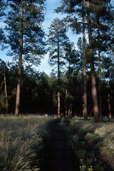
Following 20+ years as a geospatial
professional in the USDA Forest Service (35+ years in federal service), I had
been tasked with the coordination and integration of geospatial technology into
the federal agency on a local unit (i.e., on the Monongahela National Forest),
at a regional level (i.e., Region 1 based in Missoula, Montana), and at a
national level at the Geospatial Technology and Applications Center (GTAC) in
Salt Lake City. This experience taught me that the evolution of this new
technology and applied use in an ecological land management context was fraught
with complexity and required an interdisciplinary framework for capturing
programmatic content – lands, engineering, recreation, wildlife, soils,
geology, law enforcement are representative programs with professional staff
and a wealth of data that required analysis, management, and coordination.
AI models and systems hold great promise
for augmenting geospatial professionals and resource specialists in their work
as well as providing foundational insights for Agency leadership in making
decisions. Current techniques and tools exist for automating much of the
processes right now, but the integration of AI systems and task-based models
would help to not only solve real-world problems but potentially reveal
emergent and innovative approaches to natural resource management.
Current AI applications in the natural
resource and land management realm are primarily task-based and concentrated in
the remote sensing arena. Several remote
sensing examples include feature extraction and change detection, predictive
analytics, and natural language processing. Specific real-world examples that
have been developed are:
§ Future of AI in natural resource management: Self-Learning Forest Growth Model (Liang, 2023)
Mr. Liang is co-director of the Forest Advanced Computing and Artificial Intelligence Lab and is leading a project to use AI to
map global forest carbon accumulation rates (Liang,
2023).
§ Exploring artificial intelligence for applications of drones in forest ecology and management (Buchelt et al, 2024)
This article is an in-depth look at
utilizing drone technology for real-time tracking of forested landscapes for
wildfires, pests, and inventory needs to name a few.
Another great source of information on
applied AI in the geospatial world is Esri. Esri is the leading commercial
vendor for geospatial software with their ArcGIS suite of applications. They
are leading the GeoAI charge which is what they define as:
“…the
application of artificial intelligence (AI) fused with geospatial data,
science, and technology to accelerate real-world understanding of business
opportunities, environmental impacts, and operational risks. Organizations are
modernizing operations to run at scale through automated data generation and
approachable spatial tools and algorithms” (Esri,
2024).
Esri also has a free ebook available for
download which describes “AI + Location Intelligence” here.
A major challenge is that data integrity
has been and is a major concern for grappling with Big Data – those big data
pipelines are integral to not only the training and testing of data for AI, but
also for the long-term maintenance of an AI system. At the same time Agency
leadership has struggled with data governance and staffing – there will be
similar struggles for implementing AI across an organization.
Key tools for fighting wildfires (and
post-fire mitigation) will be the expanded use of drones and the real potential
of integrating AI into the battle. Fundamentally though, it will be a mistake
to dismiss the need for a highly structured methodology in not only integrating
the technologies (with robotics), but for prioritizing training needs for staff
use and incident coordination.
As AI technology matures and begins to
deploy autonomously – with model methodology making a transition to AI systems
from task-based models – there will a greater emphasis and success for working
across disciplines and engaging interdisciplinary teams in land and natural
resource management.